Other Name(s)
Fort Frontenac National Historic Site of Canada
Fort Frontenac
Fort Frontenac
Fort Cataraqui
Fort Cataraqui
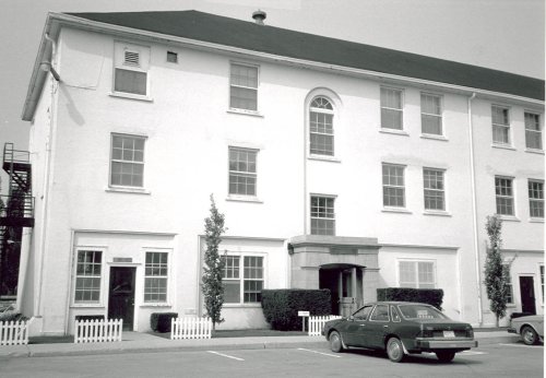
Canadian Land Forces Command and Staff College
Links and documents
n/a
Construction Date(s)
1673/01/01
Listed on the Canadian Register:
2009/04/29
 Statement of Significance
Description of Historic Place
Fort Frontenac National Historic Site of Canada is an archaeological site located beneath the intersection of Ontario Street and Place D’Armes in Kingston, Ontario. The site extends under four stone buildings, constructed during the 1820s as part of the former Tête du Pont Barracks on the southern portion of ground previously occupied by the original French fort. While these four buildings are part of a complex currently referred to as Fort Frontenac, only a fragment of the original fort can be seen today. Sections of the west and north limestone curtain walls are exposed on a traffic island at the intersection of Ontario Street and Place D’Armes. Official recognition refers to the footprint of Fort Frontenac.
Heritage Value
Fort Frontenac was designated a national historic site of Canada in 1923. It is recognized because:
- built in 1673 by the Comte de Frontenac and rebuilt in 1675 and 1695, it was, for many years, the key to the West, the base of LaSalle’s explorations and a French outpost against the Iroquois and English;
- Indigenous Peoples, their territories, and labour were foundational to the fur trade in North America. Posts were often built near existing Indigenous settlements, trading routes and/or meeting places and became important sites of economic, social and cultural exchange.
Fort Frontenac, located at the confluence of the Cataraqui River and Lake Ontario, was established in 1673 by the Governor of New France, the Comte de Frontenac, in order to control access to the fur laden lands of the Great Lakes Basin and the Canadian Shield. As the fur trade expanded west along the Great Lakes and into the Mississippi and Ohio River valleys, the explorer René-Robert Cavelier de La Salle rebuilt the wooden fort into a stronger masonry building by reinforcing it with limestone walls and square bastions. The fort became a strong French outpost against the British and the Iroquois, as several smaller buildings were built around it and a community of settlers established themselves in the region. During one of La Salle’s extended explorations of the interior in 1682, the fort fell into the hands of creditors who neglected its defences and, after an attack by the Iroquois, the French ordered the fort’s destruction in 1689. However, in 1695, the Comte de Frontenac ordered the fort rebuilt, and it was occupied by a small garrison until 1745. In 1758, the British under Colonel John Bradstreet captured the fort and it remained in British possession until the end of the War of 1812, when it was deemed obsolete and was gradually demolished. Archaeological research in 1982 uncovered several sections of antiquated limestone walls constructed by La Salle, including those sections of the north and west curtain walls that remain visible today.
Sources: Historic Sites and Monuments Board of Canada, Minutes, 1925; 2008; December 2020.
Character-Defining Elements
The key elements that contribute to the heritage character of this site include:
- its location at the confluence of the Cataraqui River and Lake Ontario, which made it a geographically strategic French outpost for the fur trade and base for La Salle’s explorations;
- its footprint in relation to the former Tête du Pont Barracks and the surrounding city streets;
- the visibility of sections of the north curtain wall and the west curtain wall, in a traffic circle at the intersection of Ontario Street and Place D’Armes;
- the remains of the various phases of the fort, in their location, extent and materials, both discovered and undiscovered;
- all archaeological remains, both underground, undiscovered and discovered that relate to Fort Frontenac.
 Recognition
Jurisdiction
Federal
Recognition Authority
Government of Canada
Recognition Statute
Historic Sites and Monuments Act
Recognition Type
National Historic Site of Canada
Recognition Date
1923/05/25
Historical Information
Significant Date(s)
1675/01/01 to 1675/01/01
1695/01/01 to 1695/01/01
1673/01/01 to 1832/01/01
1937/01/01 to 1937/01/01
1982/01/01 to 1982/01/01
Theme - Category and Type
- Governing Canada
- Military and Defence
Function - Category and Type
Current
Historic
- Defence
- Military Defence Installation
Architect / Designer
Louis de Buade Comte de Frontenac
Builder
n/a
Additional Information
Location of Supporting Documentation
Indigenous Affairs and Cultural Heritage Directorate Documentation Centre 3rd Floor, room 366 30 Victoria Street Gatineau, Québec J8X 0B3
Cross-Reference to Collection
Fed/Prov/Terr Identifier
392
Status
Published
Related Places
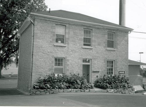
De Noyan Block
At the eastern entrance to the city, located at Fort Frontenac National Historic Site of Canada, the De Noyan Block is a simple rectangular two-storey, stone structure with a…
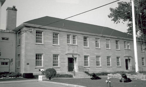
Vincent Block / Administration Office
Fort Frontenac is situated at the eastern entrance to Kingston where the Cataraqui River drains into Lake Ontario. Situated within the Canadian Forces complex at Fort Frontenac,…

LaSalle Block
At the eastern entrance to the city, located in the Fort Frontenac National Historic Site of Canada, LaSalle Block is a long rectangular two-storey, stone structure with a low…
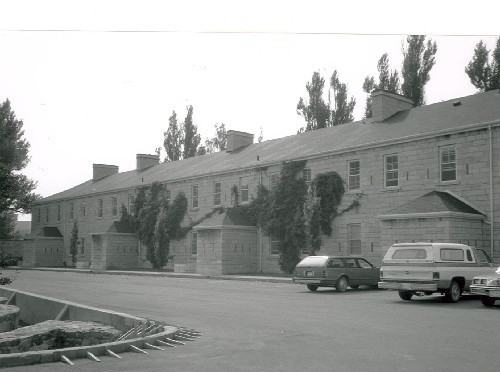
Ross Block
The Ross Block, also known as Building FF07, is located within the walled Tête de Pont barracks in Fort Frontenac which lies at the eastern edge of the City of Kingston. A…
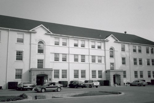
Bradstreet Block
The Fort Frontenac National Historic Site, Bradstreet Block is located within the walled Tête de Pont barracks in Fort Frontenac which lies at the eastern edge of the City of…
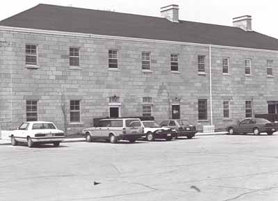
Courcelles Block
The Courcelles Block is located within the Tête de Pont barracks in Fort Frontenac which lies at the eastern edge of the city of Kingston. It is a three-storey, rectangular…
Heating Plant, former Commissariat Storehouse
The Heating Plant is located within the walled Tete de Pont barracks in Fort Frontenac which lies at the eastern edge of the City of Kingston. The rectangular stone structure has…